Motors are not permitted on the lakes this route uses. That is the whole design of the week and it is why a boundary waters vacation package half a day by canoe costs what it costs: every pound of food, every tent pole and every liter of fuel moves by shoulder and paddle blade, twice over each carry, and nothing catches up with you later. The million acres north of Ely hold about 1,200 miles of canoe routes and roughly 2,000 designated campsites, and the permit system puts a fixed number of parties through each entry point per day, which is the reason your launch date is a date and not a preference.
Portages here are measured in rods, not feet or miles, because a rod is about the length of a canoe and the old survey unit stuck. Sixteen and a half feet. A 140 rod carry is a bit under half a mile. You will hear people say a portage is "flat," and what they mean is that the climb is under a hundred feet, not that the ground is level; the ground is glacial bedrock with about four inches of soil on it and roots that hold water like a gutter.
Seven nights buys enough time to move camp three times and still have two full days where you do not break anything down. Most people who go in for four nights spend two of them traveling. That arithmetic is the argument for the longer week.
- Step
- Half a day in , Half a day
- How far from the road
- The first camp sits four to five hours in by paddle and portage, across two lakes and three carries, and once the outfitter's truck pulls out of the entry point lot there is no road, no motor and no vehicle access to any campsite you will use all week.
- What the distance costs
- Three portages on the way in measure 80 rods, 140 rods and 32 rods, a rod being sixteen and a half feet, so 252 rods is about three quarters of a mile of walking, done twice because nobody carries a canoe and two packs in one trip; the tread is wet granite, root steps and a boot-deep mud stretch on the long carry with about 90 feet of climb between the first and second lake and no gain worth naming after that; a full food pack for seven days starts near 55 pounds and drops about 4 pounds a day, the canoe adds 42 to 50 pounds on the shoulders, and a double carry turns a 140 rod portage into roughly 40 minutes rather than 12; nothing can be shuttled, floated around or driven ahead, because there is no other route to the water, and if the entry point permit date is closed by fire restriction or a wind event drops timber across the carries, the week shifts to a different entry point on the same chain rather than a different week, with the paddling distance to the first camp changing by up to two hours in either direction.
- Nights
- 7
- From
- $3,120 per person
- Shape of it
- canoe in over three portages
- What is in the figure
- Seven nights of campsites on a permitted entry point itinerary; the overnight wilderness permit and reservation fee; one 17 foot Kevlar tandem canoe per two people with paddles and floatation; two portage packs per canoe, tent, tarp, sleeping pads and bags rated to 20F; seven days of food packed per person per day with a bear-resistant food container; water filter, cook set and fuel; the entry point shuttle from the lodging north of Ely and back; one night indoors before the paddle and one after; a route map and compass with a route briefing the evening before you launch; a guide for the whole week if you take the guided option.
- What is not
- Flights into Duluth or Minneapolis and the drive north, which is roughly 110 miles from Duluth and about four and a half hours from the Twin Cities; car rental, parking and gas; personal clothing, rain gear and boots; a Minnesota fishing license and any tackle, which you buy yourself in town; alcohol; meals in town on either side of the paddle beyond the two nights indoors; solo canoe upgrades and any extra canoe if your group does not divide evenly by two; laundry, gear repair and any replacement of your own equipment; gratuities; any evacuation costs if you decide to come out early, since coming out is a paddle and a set of portages in reverse and the shuttle has to be reached by radio from the entry point; anything you would want on a rest day off the water, because there is nothing there to buy.
- Who it does not suit
- Anyone who cannot lift a 50 pound pack onto their own back, walk three quarters of a mile over wet rock and root with it, set it down and walk back for the canoe. Anyone who needs a flush toilet or a shower during the week: the campsites have a steel fire grate and a box latrine back in the trees, and that is the whole infrastructure. Anyone who wants the option of a car, a store or a road at any point between launch day and takeout day, because there is not one.
What the ground and the water are actually made of
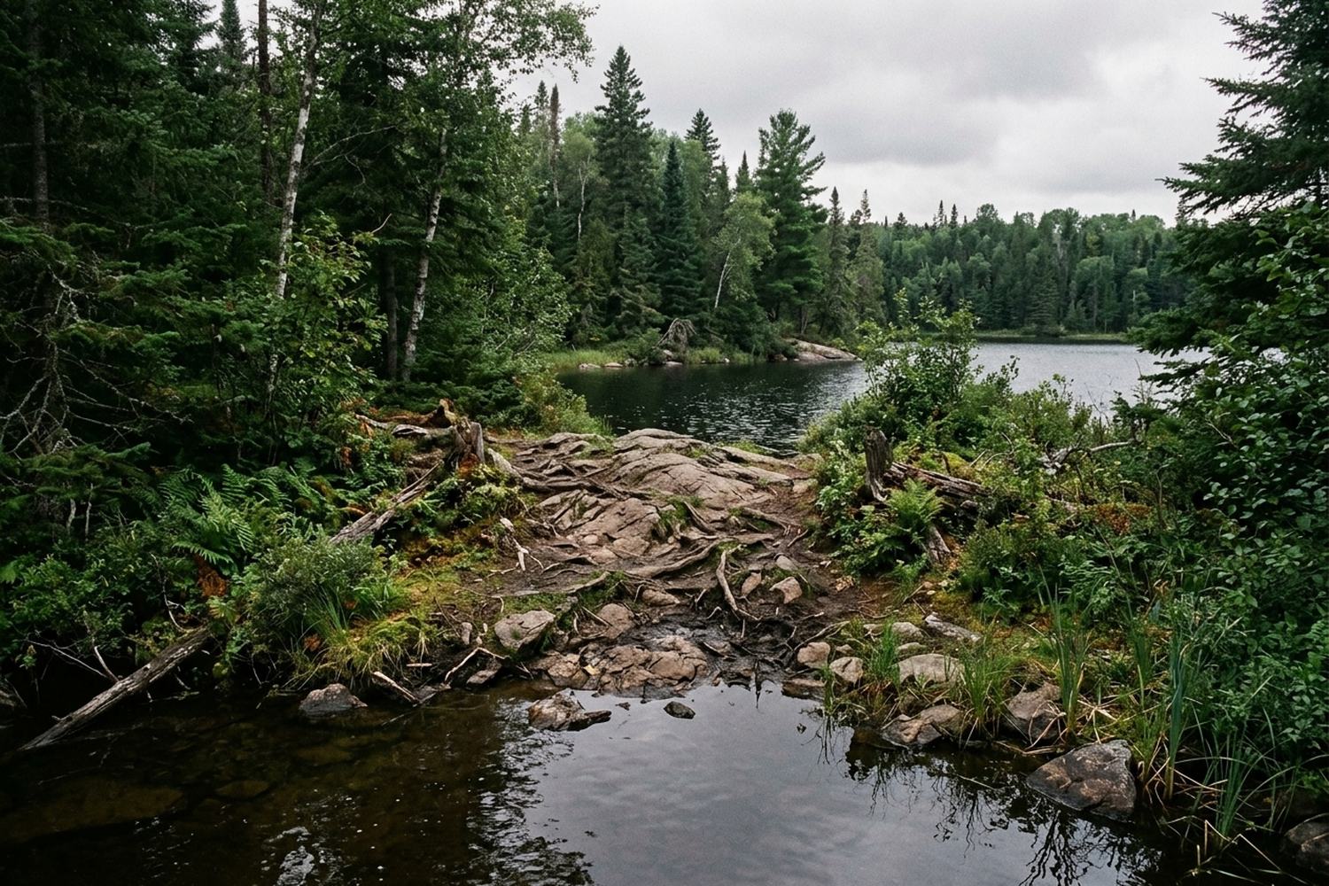
The bedrock is some of the oldest exposed rock on the continent, Canadian Shield granite and greenstone, scraped bare by ice and holding lakes in the low spots. Shorelines are rock shelf or boulder, rarely sand. Campsites are set on those shelves because there is nowhere else flat, which means your tent pad may be four tent-widths from the water and eight feet above it, and getting a loaded canoe in and out means standing shin-deep on slick rock.
Depth changes fast. You can be over 60 feet of water 30 feet from shore on the deeper lakes and in three feet of water half a mile out on the shallow ones. Wind matters more than distance: a 15 mph west wind on a two mile open crossing puts up a foot of chop and turns a 40 minute paddle into 75, and the standard answer is to hug the north shore and cross at the narrows rather than argue with it.
The forest is red and white pine on the ridges, black spruce and cedar in the wet ground the portages cross, and birch and aspen filling in where the 1999 blowdown flattened 477,000 acres and where fire has since run through parts of it. You will walk portages where the standing timber is 25 years old and thin, and others under pine that predates any of it.
The months this works, and the two that do not
Ice out on these lakes runs mid April to early May, and the water stays in the 40s Fahrenheit for weeks after it. Black flies come with leaf-out and peak for about three weeks; mosquitoes take over from there. By late August the bugs have collapsed and the water is warm enough to swim, which is why that window fills first.
- Mid April to early May
- Ice out, water in the 40s F, portages muddy and running with meltwater, almost nobody else on the chain
- Late May to mid June
- Black flies at their worst for roughly three weeks, high water makes the shallow carries shorter, daytime highs 60s to low 70s F
- Late June to mid August
- Warmest water, mosquitoes at dusk, the busiest permit dates, occasional fire restrictions that ban open flame and move the route
- Late August to mid September
- Bugs gone, highs in the 60s and 70s F, nights in the 40s, first color in the aspen by the second week of September
- Late September to freeze up
- Nights below freezing, wind stronger and more sustained, daylight down to about eleven hours, few parties on the water
- Late November to March
- No paddling route exists, lakes locked, this trip is not sold
Fire restrictions are the variable that moves a booked week. They are declared by the forest, not by us, and they can arrive four days before your launch. What they change is whether you cook on a grate or a stove and sometimes which entry point is open at all.
What is fixed at confirmation and what is not
The permit is the piece with a hard edge. It names an entry point and a launch date, it is issued to a named party of no more than nine people and four watercraft, and it cannot be moved to another date once it is drawn. Everything else, meaning route, campsites, how far you go each day, stays flexible right up until the morning you launch, because campsites are first come and nobody reserves them.
- FigureWe send the seven night figure with the entry point named, the number of portages to the first camp and the double-carry time estimate written out, two to four working days after your message
- Deposit and permitA deposit holds the reservation and the overnight permit is drawn for your launch date and party name; from that point the date is fixed and the route is not
- Gear and food callSix to eight weeks out, we settle pack weights, canoe count, the food plan per person per day, and whether you are taking a guide for the week
- Route briefingThe evening before launch, at the lodging, with the map open: three candidate routes, water levels, current fire status and where you go if the wind is wrong on the first crossing
Ask about the carries before you ask about the price
Tell us how much you want to be walking with a canoe on your shoulders and we will tell you which entry point on this chain matches it, because the difference between 252 rods and 700 rods to the first camp is the difference between two very different weeks. Send a message and it is read the same working day.